Brookside Farm

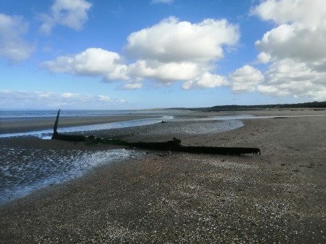
June is a time for colourful flowers coming into their best blooming, & also, it seems, in 2020, a marked increase in traffic on the roads & buses following the first easings of the boa constrictor lockdown in Scotland. People can finally go for a drive & a walk in more remote places without people slapping invasive notes on car windows… so where to go?

Well, there is this next walk, a real buffet treat of scenery & ruins & vasty vistas, revealing yet again how microcosmic East lothian is when appertaining to the rest of these islands.

HOPES
From the History of Garvald Parish

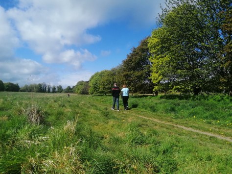
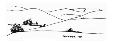
Once you’re getting stuck into the hills behind Brookside Farm, you coud easily picture yourself in any of the savage, windswept peak-topp’d ranges of Britain. But I am getting ahead of myself a tad, & before we reach said scenery let us first take advantage of parking the car!

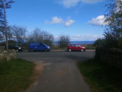
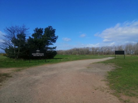
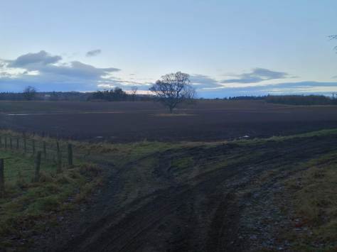
There is a 90 degree turn on the country road between Danskine/Newlands & Castle Park Golf Course where theres plenty of space to park the car.  You’ll immediately be struck by the highland scene to the west in which direction we’ll now be going.

The view from the farm track looking north

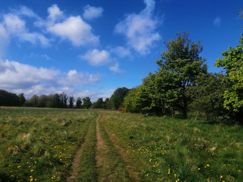
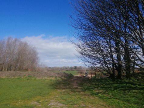
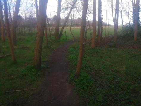
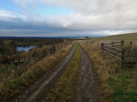
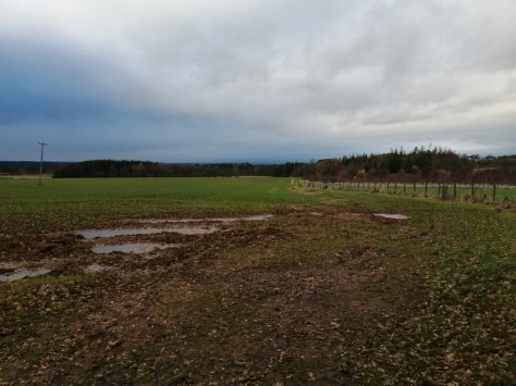
A farm track carries you nice & straight for a while, before you reach a gate – hop over this & enter the sloping sheeplands, meaning dogs on leads, or in Daisy’s case, my girlfriend’s arms.

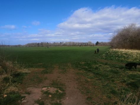
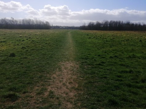
Continue west with the ‘tree farm’ on the right & the sheep scatterings on the left. As you traverse the big field you should pass a weird old iron farm machiney thing – don’t know what it once was (answers in the comments, please) but now its a great marker for the walk.

The Developing View

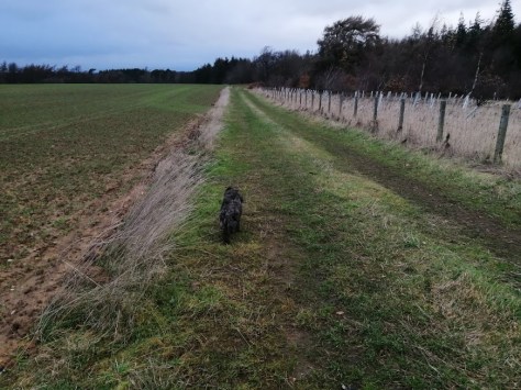
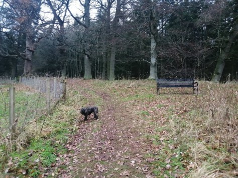
At the end of the field you’ll come to two sets of gates, like a lock system on a canal, which you should pass through.

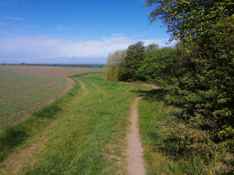
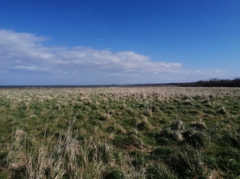
We are now in another field, sloping gently downwards in the direction of The Hopes – a wonderful walk we’ll get to in due course.

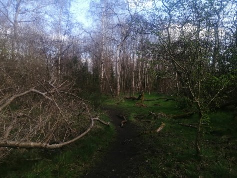
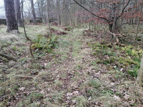
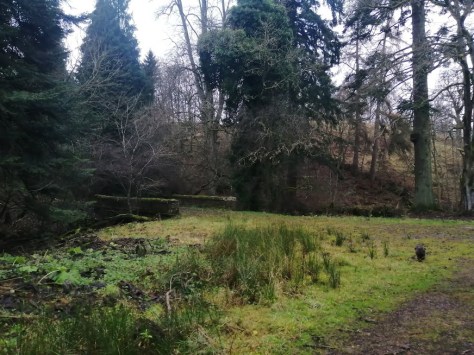
Half way along, hop over the fence & find youself on a track with the ruins of two farm buildings in the valley below – welcome to Brookside.

In the background is the conical hill which was home to two Gododdin camps (see later in the post)

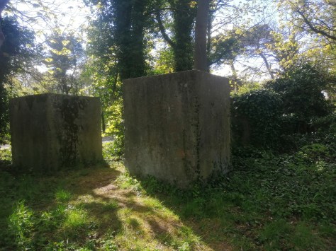
There are two ruins at Brookside, & the first one you come to is a hive of exploration, masonry & birdnest chimneys. The setting is serene & the scenery sublime.

The second building

Brookside was once one of three farms – with East Hopes, West Hopes – that created the Hopes estate. There is a lovely old poster produced to publicise the sale by auction (roup) of over 1000 animals – the stock in hand on the farms of Snawdon and Brookside in 1813. It may have been prompted by a change of lease, retirement, or even sequestration. The farms had probably been worked in tandem, with Brookside deeper into the Lammermuir Hills being used for pasturage.

A mixed husbandry was practised by a band of East Lothian’s upland farms along the east-west line of the Lammermuir foothills. The higher ground was used for grazing and the better lower ground for arable and fodder crops. This pattern was well established by 1813, as the poster reveals.

Looking back towards the farm

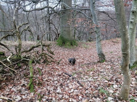
The walk now carries on up into the hills behind Brookside, following the very brook on which side the  farmhouse is built. We’re not the first ‘out yonder uns’ to tread these paths. In his Reminiscences of the Royal Burgh of Haddington and Old East Lothian Agriculturists (1883) John Martine mentions in a chapter on the ‘Old Camps’ of the county, some of which we explored along the Gododdin Heritage Trail. Look out for some really interesting local colour alongside acute & warm accounts of the old farmers. One of them, David Darling, delighted in showing visitors the historical heritage of the spot, in the same way I’m buzzing off showing this wonderful ruin to the walkers of the East Lothian & beyond. It really is a treat. Martine says;


ON the East Lothian side of the Lammermuir range of hills, from Nether Brotherstones on the west, to Priestlaw on the south-east, there are upwards of twenty old camps or hill forts. The positions of them are marked in Forrest’s excellent map of Haddingtonshire, published in 1799, and now scarce. They are to be found at Upper and Nether Brotherstones, West Hopes, Brookside, Longnewton, Kidlaw, Longyester, Park Hill, Whitecastlenick, Kinisidenick, Kilmadie Burn, Priestlaw, Penshiel, Garvald, &c. They number twenty-one in all. They are all circular or oval, and perched on the tops of hills and lofty eminences, and different from Roman camps, which were square or longitudinal. They have rings, or mounds of stones and earth, or circumvallations, with corresponding ditches around them. Formed at a very early date in the history of the country as places of defence or habitation,

Forrest’s map

It is the purpose of the writer to notice two of these camps or hill forts, which are on the farm of Brookside, in the parish of Garvald, on the Hopes estate. Placed on the top of a conical hill of moderate height, the one towards the south side is the larger of the two, and on a higher elevation. It has five circular rings formed of gravel and soil around it quite distinct, especially on the north side, with ditches and several entries through them to the centre of the camp, which are still discernible. The centre occupies a large space of fine pasture grass. The south side of the hill is precipitous and rugged, and would be found difficult to an enemy to ascend if opposed. At the bottom is a pretty valley, with a mountain brook running through it. The hillsides and valley are clothed with juniper bushes, mountain ashes, scrubby saughs, &c. Looking down from the hill-top, the valley or glen is of singular beauty. There is a most magnificent view to the north and west of the lower parts of East Lothian, the Firth of Forth, with its islands of Fidra, Eyebroughy, the Lamb, Craigleith, and the Bass; Fife, Pentland Hills, Arthur’s Seat, &c. The fatigue of travelling and climbing the hill is amply repaid by the splendid view.

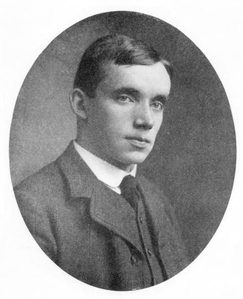
The other camp to the north, and nearer Brookside, is similar, but much smaller. Mr David Darling, who with his father farmed Brookside for forty or fifty years, and who lately retired from it, was most kind and hospitable to visitors, and. took much delight in telling his friends about the camps, &c. Stone arrow-heads, hatchets, with lots of human bones, relics of former days, have been found from time to time, and no doubt many more may be found, if search were made for them. The sheep and lambs, fond of basking and lying under the banks of the rings, which they have in many places rubbed bare, point out the fact of the artificial formation of these mounds or rings, which have been originally formed of rounded stones and gravel.

The wildest part of the Lammermuir Hills is at Brookside and on the adjoining farm of West Hopes. A more enchanting spot in a fine summer day is perhaps not to be found in the county of East Lothian. From Hopes Bridge, looking up the beautiful glen, with Lammer Law in the distance, the view is uncommonly fine. In the month of July, when the bell heather is in full and splendid bloom on the hill sides and tops, a day’s ramble among the Lammermuirs will, to a lover of wild and beautiful natural scenery, afford much delight; and when he comes to view the camps of Brookside, if he is of a contemplative mind, he will wonder how the old inhabitants of this land could live in their hill-forts, clothed in skins of wild beasts, and depending for their daily food on the chase and slaughter of wild animals and birds, while resisting the attacks of their enemies with slings, bows and arrows, and flint-headed javelins.

The counterpart of such a state of life in the hills and mountains of Scotland at that time may at this day, perhaps, be found, but on a much more extensive scale, in the mountainous country and savage tribes of Afghanistan or Zululand. The late Hugh Miller once visited the old camps at Brookside, and was much impressed with the wildness and grandeur of the scenery, which he took notice of in a lecture he delivered in the Free Church of Yester. He went fully into the geological history of the formation of the Lammermuirs, &c., with notice of the granite on Faseny Water, &c. The lecture was intensely interesting.

At one time a heronry existed in a clump of large trees above Brookside steading. Mr David Darling’s respected father had a peculiar notion about the herons and the state of the weather. When the birds took it into their heads to fly down the burn of Brookside, he cried, shouted, and hounded them up again, thinking that when they came down there would be bad weather, and if again they fled up the burn there would be fine weather. Hill farmers and shepherds are good observants of such instincts of birds and animals. In no part of Lammermuir does the snow, after a severe winter, lie so long as on the hills and in the gullies and scars of Brookside, and the West Hopes. Often far on in June have patches of hardened snow been seen on the hill-sides there. Energetic boys from Gifford, &c., on a holiday have often gone up in gangs to the hills and scattered the snow, declaring it was a terrible thing to see snow lying on the hills in the warm month of June.


brookside


In the excellent ‘Garvald, the History of an East Lothian Parish’ by Irene Anderson MBE – which you can read in full here – we can read a little more about David Darling.

Throughout that time the schoolmaster, William McGregor, was also the session clerk. William was schoolmaster from 1845 until 1876. Two other long-serving elders were Robert Taylor of Carfrae and David Darling of Brookside, both life renters on Tweeddale land. Both these men succeeded their fathers on the same farm…. There are still considerable ruins of the house at Brookside but it is difficult to imagine how such a small acreage of land could have supported men of such standing. David Darling must have been a very committed elder because it is about eight miles across country to Garvald and he regularly attended the session meetings!


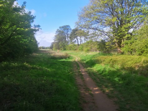
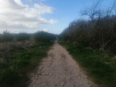
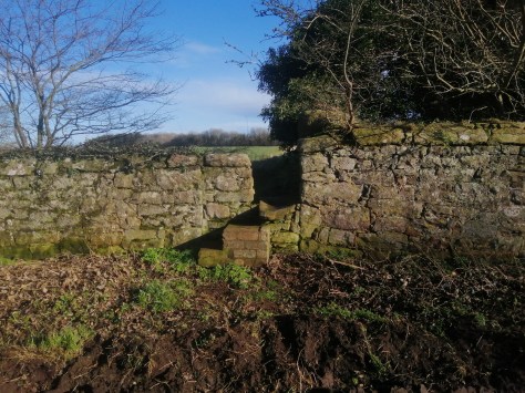
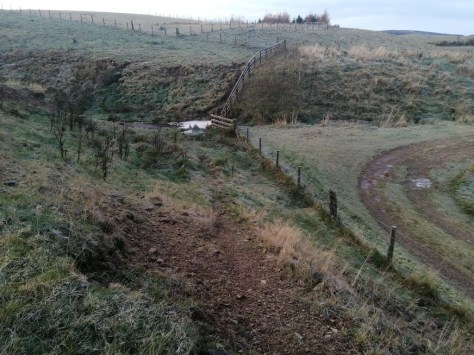
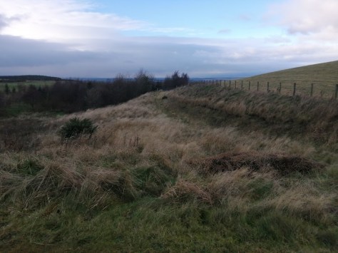
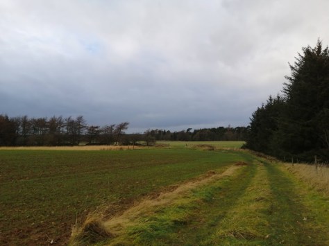
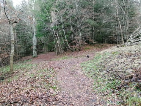
We are now entering open countryside – apart from the huge flanking heaps of Lammermuirs of course. On the right is the conical hill with the forts – I wasn’t in the mood for exploring them on this day, but of course they’re fair game for anyone in the vicinity. Eventually, on the left, you’ll come to the gate in the picture below – take it & head up the slopes.

The view back towards the farm

At the top of the slope, start heading east – skirting the fence & passing a couple of impressive mounds which might even be tumuli connected to the Battle of Badon (read more here). They are sited less than a mile & a half to Dun Badon (The Castles) & the phraseology of Nenniu’s ‘Arthur penetrated to the hill of Badon ,’ implies a defence system in the foothills of Lammer Law.

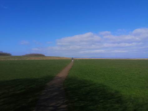
Just beyond the tumuli the view opens up & it really is worth it – East Lothian in its prime & in its glory is a sensational aesthetic. You can even trace most of previous Walking East Lothian paths from here, over a picnic & a spritzer.

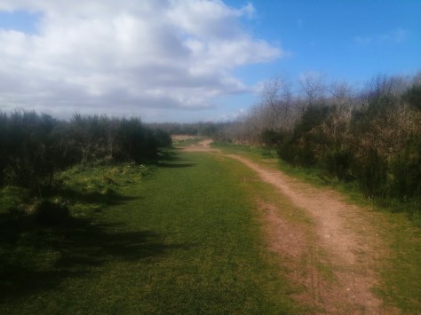
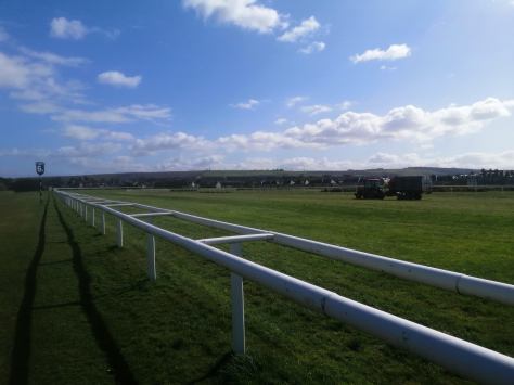
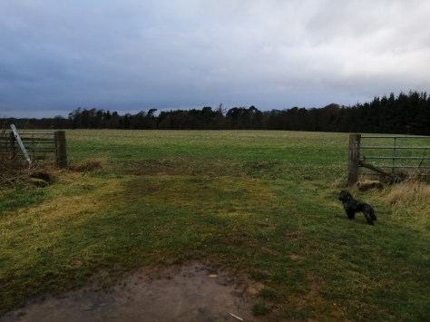
So its time to get back to the car. Simply follow the path to a gate, enter a massive field & veer forward left to a gate in the middle of a treeline.

Over the fate you follow a track a wee while til it opens up into a large field. Turn right & just meander back to the car. Its a good way still but pleasant & spacious & airy.


To contribute petrol & petfood

Please make a donation

***

Canty Woods – Daisy Way – Longniddry Bents


This next walk’s a good un, a really nice blend of woodland, open spaces & the sublime shoreline of Longniddry Bents. It starts at a parking spot at the south end of Dean Road in Longniddry, just near the junction with the A198.

You can also get there from the B1348 Links Road, & there is indeed a carpark at the junction – but you might as well park up the road for free.

IMG_20200428_115102

IMG_20200428_150706

The car should be next to a wall opening which leads into Canty Wood, or Longniddry Dean as its also called. Turn left here & follow the woodland path for about 100 meters.

IMG_20200428_103030

IMG_20200428_103239

You will come to a spot where there is a primitive ford across the burn to one’s right – take this & emerge in an open field.

IMG_20200428_103339

IMG_20200428_151040

IMG_20200428_103351

At this point turn right & skirt the woods as they lead bend north towards the sea.

IMG_20200428_103407

IMG_20200428_103733

IMG_20200428_104203

IMG_20200428_104251
Its possible to access the woods here on the right, but we’re carrying on straight ahead

You will eventually come toa path through the woods which leads to an open are of greenerie with the golf course on one’s right. At the end of this verdant belt you reach a path. Turn right & head towards the links road, with Seaton Sands caravans on the left, & the ninth holf of the golf course on one’s right.

IMG_20200428_104610

IMG_20200428_104625

IMG_20200428_104634
The start of DAISY WAY

IMG_20200428_110236

IMG_20200428_111331
Longniddry Golf Club

Mary Queen of Scots was known to be playing golf in the area of Longniddry in 1567 – ‘over the fields of Seton’ – shortly after the murder of Darnley and was admonished accordingly! It was another two hundred years, however, before the 7th Earl of Wemyss & March bought land at Gosford ‘to be nearer the golf’ and a further one hundred and fifty years before the 11th Earl of Wemyss invited Harry S. Colt to design and build 18 holes. 150 acres were made available and thousands of trees were cleared to create a course measuring some 6,369 yards. Some of the felling occurred in (what was) the Boglehill Wood, thought to be a site of worship for local witches and warlocks and now the site of the 6th and 10th greens.

The photograph above commemorates the inaugural match shortly after the course opened in 1921 when James Braid & Ted Ray took on JH Taylor & Abe Mitchell in a 36 hole fourball match. 4000 spectators were estimated to have watched the match between these four famous professionals, including two of the Great Triumvirate, the third being Harry Vardon. Braid & Ray shot 70 & 67 against the 71 & 73 of Taylor & Mitchell to win the match. According to Braid’s ledger, he received £10 in either appearance or prize money. The four professionals are in the second row of the photo, with George Taylor Longniddry’s first professional, second from the left. In the middle, wearing a bow-tie is Stuart Forsyth, proprietor of retailers RW Forsyth which had prestigious stores in Edinburgh & Glasgow. Stuart Forsyth was elected in 1935 as the first Captain of Longniddry Golf Club. The 11th Earl & Countess of Wemyss are in the front row.

IMG_20200428_163601
Daisy met a baby

IMG_20200428_111525

As I traversed this stretch with my ever faithful dog, I ask’d a local if the path had a name – apparently it doesn’t, & I thought it a splendid idea to call this bit of Walking East Lothian – The Daisy Way. I’ll pay for a Greyfriar’s Bobby Style Statue along it somewhere if the council let me.

IMG_20200428_111745
Turn right here

IMG_20200428_111808

IMG_20200428_112008


IMG_20200428_112039

IMG_20200428_112110

IMG_20200428_112154

At the end of Daisy Way, cross over the road & enter Longniddry Bents – a wonderful world of dunes, sand & sea. The basic idea is to head east, & you can either go along the beach, or path through the dunes or the woods – three ways, a veritable trident of possibilities.

IMG_20200428_112206

IMG_20200428_112228_1

Longniddry Bents is known best for its plant life. The base-rich soils have allowed a number of plants to flourish here that are only seen occasionally elsewhere in the county. In May, yellow cowslips are abundant, their nodding heads enabling you to tell them apart from their close relative, the primrose. Cowslips are quickly replaced by bloody cranesbill, bright pink-purple flowers that occur in clumps. Alongside the flowers, this section of coast attracts a number of sea duck and wading bird, together with sandwich terns during summer.

IMG_20200428_112241

IMG_20200428_112334

The area is popular, mostly in the summer months, with local families, holidaymakers, picnickers, horseriders, ramblers, metal detectors, dogwalkers and the occasional kite buggy. The shallow bay is a popular watersports location for windsurfers, kitesurfers and sea kayaks. Many sea and wading birds frequent the area making it a regular haven for bird-watchers. A small community of rare water voles are known to reside around the several burns running out of the bents. Grey seals are often spotted to the west of the bay.

IMG_20200428_112343

IMG_20200428_112516

IMG_20200428_113123

If the tide is out you get to see cool relics of maritime past, while at the land-edge or concrete blocks designed to keep out Nazi tanks.

IMG_20200428_113158

IMG_20200428_113258

Eventually there appears a gap in the dunes along which a path snakes to the Links Road, passing the aforementioned paying car park.

IMG_20200428_113332

IMG_20200428_113349

Before we leave Longniddry Bents, lets just fly quickly yo Canada & the desrted hamlet of Bents, Saskatchewan, named after Longniddry’s bents, but in the middle of a vast continent & not by the sea.

Bents was officially established in 1930 along a CPR rail line that ran between Perdue and Rosetown. At one point Bents boasted several residential homes, a small train station, two grain elevators, a dance hall, a general store (Longworth’s General Store) and post office – all along a single street. By the 1960s the town began an irreversible decline when the southern section of the rail line was abandoned.

Today, little remains. Only one of the two elevators, the Saskatchewan Wheat Pool elevator, still stands. There are two houses left. One, belonged to a huge family and the other belonged to an auctioneer.

The general store/post-office is still there but in badly deteriorated condition. There are random outbuildings and old farm machinery dotting the former town site. There is also a metal swing-set, missing the swings, sitting alone in the grass beside the general store.

IMG_20200428_113412

IMG_20200428_113430

IMG_20200428_113456

IMG_20200428_113516
No Nazis Allowed

IMG_20200428_113537

Crossing the road here gives you access once more to Canty Wood, a delightful carouse of which will bring you steadily uphill to the car!

IMG_20200428_113556

IMG_20200428_113628

IMG_20200428_113745
The path is to the right of the road

IMG_20200428_113903

IMG_20200428_113915

IMG_20200428_114130

IMG_20200428_151836


To contribute petrol & petfood

Please make a donation

***

Around New Winton

What a wonderful series of sunny days. It always happens in Scotland like this. You get some kind of sustained period of sunshine in April or May, which gets everyone saying its going to be a great Summer, then there might really only be one more period like it all the way through to September. Anyway, bets enjoy it while we can.

This new walk was created over three visits. New Winton is on the route of one of my dogwalks, while dogwalking is allowed under the government rules as employment which can definitely not be done indoors. The reason it took three visits is that the walks around New Winton are almost as labyrinthine as the palaces of Knossos.

There are three routes to follow, all of which start from a small parking space by the side of the B6335, about 300 meters to the south east of the town of the village. I don’t really need to write so much about where to go, its all quite logical & also fun to explore. After Walk Two there’s a wee write-up about New Winton, while in the middle of Walk One there’s me reciting some Chinese poetry!


WALK ONE: SANDY WALK
Red

The Car Park

*

A crossroad of sorts – to the left is Winton Loop North – straight ahead is this walk
The intersecting path (Path B) follows the route of the old railway line – there was once a Winton staion nearby

Lots of cyclists in the area

Both left & right courses work
The left course

The gate back to the old railway


WALK TWO: THE WINTON LOOP (SOUTH)
Blue

Looking across the road from the car

The fork in the path – bare right

Bramble bushes on the left

Here you can take the first path left & head back to Winton via aa field, or go on a bit further & then turn right through woodland

From the road head into the field & bare right to arrive back at the carpark


NEW WINTON VILLAGE


New Winton possesses a charm that is not relative to its size. It dates back to the mid 19th- century when the original houses were built by Lady Ruthven of Winton House to replace ones close to falling down near to the main house.

The modern houses being built on the other side of the road

The Square at New Winton comprises a mix of predominantly 19th century cottages, built by Lady Ruthven. On the opposite side of the road a small square has been built, and Gilbert Ogilvy designed some of the houses in the 1930s. The whole makes a delightful rural scene.


WALK THREE: WINTON LOOP NORTH
Black


Heading along the old railiway route

A relic from the railways

Turn left at the boulders

Do NOT take this bridge, but you can if you want obviously

Reaching the main road – New Winton is to the left


To contribute petrol & petfood

Please make a donation

***


Levenhall Links

Ah Coronavirus, the hysteria across the planet is through the roof, except for Sweden & Belorussia, the latter of whom possesses the only football league playing anywhere. The only thing people in the UK are really allowed to do is, well, walk, but the Facebook groups are on fire with chat about people going for drives in the country, so I thought I’d find an accessible urban walk instead.

IMG_20200402_122229.jpg

So get yourself to Levenhall village, on the eastern edge of Musselburgh, & for the aspiring gentlemen one of the best places in East Lothian to live. There’s a decent pub, a lovely local community shop, a nine hole golf course, a racetrack & to walk the hounds the wonderful Levenhall Links.

IMG_20200402_122345.jpg

IMG_20200402_122544.jpg

The best place to park is along the road, Hope Place, that heads to the sea from the pub. At the end of the road the open expanse of Levenhall is revealed.

IMG_20200402_122655.jpg

IMG_20200402_122710.jpg

Follow the path awhile, but instead of bearing left to skirt the racecourse, carry straight on towards the sea. After a wee while you’ll reach a long , straight path which you will take to the right.

IMG_20200402_122814.jpg

IMG_20200402_122838.jpg

IMG_20200402_123027.jpg

At the end of the track, turn left at the trees & skirt them for a wee while with the woods on your right & the open greenery on the left. There are two paths breaking into the woods, & its better to take the one about two thirds of the way along the woodline.

IMG_20200402_123049.jpg

IMG_20200402_123244.jpg

IMG_20200402_123301.jpg

IMG_20200402_123411.jpg

IMG_20200402_123533.jpg

The path meanders forwards & to the left, & breajs out into the level greenery, Here one should head towards the sea, when you will soon come to a long straight path. take this to the left.

IMG_20200402_123616.jpg

IMG_20200402_123913.jpg

IMG_20200402_124010.jpg

IMG_20200402_124037.jpg

IMG_20200402_124356.jpg

You will now skirt the Bird Reserve to your right until the path opens up to a new wide space – straight ahead is the lovely little artificial lake at the heart of the area, which we will take to its right.  The lake is one of two areas of Levenhall Links that have been designated as part of the Firth of Forth Special Protection Area and are an important roosting site for wading birds at high tide, and the only major roost between Cramond and Aberlady. The boating lake attracts up to 200 wigeon who graze on the bank during the winter.

IMG_20200402_124855.jpg

IMG_20200402_124920.jpg

Levenhall Links are one of the most popular sites for birdwatching in the vicinity of Edinburgh. The ash lagoons have provided a roost site for gulls, shorebirds and terns; while the seawall provides excellent views of the flocks of sea ducks such as common eider, velvet scoter, red-breasted merganser, long-tailed duck and common goldeneye. Many rare visitors have been seen over the years including white-winged scoter, surf scoter, Wilson’s phalarope, western sandpiper, marsh sandpiper, Franklin’s gull and citrine wagtail. It has hosted three terns which had their first occurrences for Scotland here; namely Forster’s tern, lesser crested tern and royal tern. It is also one of the most regular sites in Scotland for the Mediterranean gull.

IMG_20200402_125007.jpg

As the lake bgins to curve left, instead continue in the same direction  like a sattelite sling-shot, & follow the long straight path to the sea.

IMG_20200402_125131.jpg

IMG_20200402_125239.jpg

IMG_20200402_125319.jpg

IMG_20200402_125532.jpg

At the sea-wall, turn left & head in the direction of distant Edinburgh along National Cycle route 76. Today was a wild & windy clear vistas wonder, when its always a pleasure to be beside the Forth. I encourage future tenants of this walk to check on the weather first to get the fullest pleasure from the experience.

IMG_20200402_125543.jpg

IMG_20200402_125830.jpg

IMG_20200402_130121.jpg

IMG_20200402_130128.jpg

When you reach two concrete bollard thingies, turn left & head into the Levenhall hinterland. On the right are still grassed over ash mounds from which Levenhall Links is kinda formed.  The 134 hectares of land were reclaimed from the sea by building a sea wall and pumping large amounts of pulverised fuel ash from teh now-no-more coal fired Cockenzie Power Station into a number of ash lagoons.

IMG_20200402_130243(1).jpg

IMG_20200402_130553(1).jpg

At the junction below, turn left.

IMG_20200402_130614.jpg

IMG_20200402_130628.jpg

IMG_20200402_131100.jpg

IMG_20200402_131110.jpg

Follow the long, straight path for quite a while until just before you reach the loch again. Then, at a point like a bicycle burn, turn right & head across the greenery to the barriers towards the racecourse. At this point turn left & follow the barriers towards the start point, or perhapes even head along a woodland path instead which runs parralel to the barriers.

IMG_20200402_131119.jpg

IMG_20200402_131309.jpg

IMG_20200402_131345_1.jpg

THE RACE COURSE

Musselburgh Racecourse is the second biggest racecourse in Scotland (the first being Ayr) and the fourteenth biggest in the UK.The course offers both flat racing and National Hunt meetings (though it only introduced jumping in 1987) and is 2 km long. The first races in Musselburgh took place in 1777 under the auspices of the Royal Caledonian Hunt. Between 1789 and 1816, race meetings were held on the sands at Leith, although some races did still take place in the town. In 1816, they returned permanently to Musselburgh, to a course that had been laid out for them by the town council. The Hunt were so pleased with the new course that they distributed 50 guineas amongst the town’s poor.

IMG_20200402_131819.jpg

THE GOLF COURSE

Musselburgh was once certified as being the oldest golf course in the world by Guinness World Records (but more recently they reassigned this ‘record’ to St Andrews). There is documented evidence that golf was played at the links in 1672, and it is claimed that Mary, Queen of Scots, played nearby (at Seton) in 1567. Musselburgh Links was originally seven holes, with an 8th added in 1838 and the 9th in 1870. Musselburgh was one of the three courses which staged The Open Championship in rotation in the 1870s and 1880s, alongside Prestwick and the Old Course at St Andrews. It was selected because it was used by the Honourable Company of Edinburgh Golfers, and it hosted six Opens in all, the first in 1874 and the last in 1889.

The Parralel Woodland Path

Daisy Napping Afterwards

To contribute petrol & petfood

Please make a donation

***

Sauchet & Stenton

Am I actually breaking away from the Death-Star grip of the Gododdin Heritage Trail for 2020? Indeed I am, & I’ve found a cool one to start. It begins by parking the car just to the south of the Ruchlaw Mains pig farm, which lies on the road between East Linton & Stenton. You can’t really miss it for the smell, I mean, the family business farms over 27,000 sows and 1,000 ewes & they make a decidely interesting pong.

IMG_20200220_125857(1).jpg

Cars are a bit fast here & you park right by the road, so  pop your dog(s) on a lead before you let them out. Crossing the road will only take a few wee doggy leaps, by the way, to the stony stile, which forms the entrance to what will be a circuitous walk.

IMG_20200220_135722.jpg

You are now in a field with, on one side, excellent views of the rocks of East Lothian – Traprain, North Berwick Law & the Bass. On the other side you’ll catch a glimpse of the pastel white, 3-storey L-plan Ruchlaw House.

1240x600_EDN150032_30.jpg

Built in the early 17th century for local nobleman Archibald Sydserff of Lowden, Bailie of Edinburgh, this baronial property was bought in 1950 by famous Scottish playwright, screenwriter and physician James Bridie. Well, this was a pseudonym actually, for Osborne Henry Mavor, who took his pen-name from his paternal grandfather’s first name and his grandmother’s maiden name. After serving as a military doctor during World War I, he turn’d his attention to writing comedy plays, becoming a full-time writer in 1938, the first chairman of the Arts Council in Scotland & founder of the Citizen’s Theatre in Glasgow (1943).

James_Bridie_005.jpg

He returned to the army during World War II, again serving as a doctor before becoming instrumental in the establishment of both the Edinburgh International Festival & the Glasgow College of Dramatic Art, part of the Royal Conservatoire today. The Bridie Library at the Glasgow University Union is named after him, as is the annual Bridie Dinner that takes place in the Union each December. All of that form lofty laurels indeed, but there’s more, for Bridie even worked with the director Alfred Hitchcock in the late 1940s on Under Capricorn (1949) & Stage Fright (1950).

For film buffs, Under Capricorn is renowned for this epic double-shot six and a half minute sequence (a 1m40s take combined with a 5m20s take); elaborately staged to move in and out of the house and back and forth through multiple rooms, while the new guest (Wilding) pieces together the subtext being revealed, all of it leading up the dramatic introduction of the mistress of the house for the first time in the film. Quality stuff & among of the last pieces of art Bridie would have enjoyed before his death by stroke in Edinburgh, 1951.

129847
James Bridie – 1948

Follow the path to the trees, but instead of hopping over the wall into the woods (we’ll be coming back this way), turn left instead & skirt the trees for a while.

You will soon enough get a fine view of a fine wind turbine, with a wonderful vista of eastern East Lothian as a backdrop. The big white spinny thing caused quite a flutter among the agricultural community when it was first erected on account of it being the brainchild of a prodigal son returning from university. Jamie Wyllie of Ruchlaw Mains Farm had studied Agriculture and Business Management at Reading University, & having completed his dissertation on renewable energy, basically blagged his dad it was a good idea to set up a Vergnet turbine for all their power needs & benefit from the Feed‐in Tariff that sells the excess back to the grid. One expects that from the recent exploits of Storm Chiara & Storm Dennis they’d have made a few extra bob.

Wyllies-Farm-Ruchlaw-East-Lothian-image-1.jpg
Jamie and James Wyllie with their Vergnet GEV MP-R 250kW wind turbine (2013)

‘It’s worked well,’ pointed out Jamie at the time, ‘ it’s more immersed in the local landscape than a larger turbine may have been,’ & it definitely does blend in quite well to the contours. Jamie also stated that,  ‘we can see exactly how much it produces every day through information fed back to our mobile phones,‘ which is just so, well, real!

Back on the walk, continue skirting the trees til you come to an opening & a rising track – take this. It leads you to a handsome field, which you should skirt to the left.

You eventually come to a drop into another field, at the bottom right corner of which is the access to the woods. There’s no opening as such, just a load of fallen moss-covered stones, a bit like when copper coins turn green in fountains.

So we’re now in the woods, which has lots of uppy-downy bits, riverside snowdrops,  budding wild garlic, plus a tangl’d heap of well-marked out paths. The general idea is to head west – you can’t really go east anyway – & cross the Sauchet at a bridge.

There are 3 sub-loops to the main path, a kind of vegetated quarry vibe at the start, a brilliant riverside loop in the middle, plus a neat little riverside diversion just before the bridge. I mean, this walk isn’t the longest in East Lothian, but its certainly one of the most satisfying, & the loops are ideal to stretch out the time a bit.

The start of the central loop – its better to stay right here (POINT A)

Approaching the second entrance to the loop
Following the central loop back along the river

It was by the Sauchet Water that a Late Bronze Age axe was discovered, a Kalemouth variant of the Type Portree. It is untrimm’d, socketed, with a smooth green surface brittle in places, haft ribs, plus scratch marks on the blade. Measurementwise its length is 73 mm, mouth 22 x 28 m,m,. cuting edge 47 mm & weight 205. All records of its original owner have been lost.

The steep path up to the main path (POINT A)

Once satisfying a natural compulsion to do the loop, carry on beyond the second entry point, this time keeping right, you’ll soon come to a y-shaped fork. Turning back on yourself on the right prong will take you back to the beginning of the walk, but first things first we’re gonna carry straight on & reach the bridge, cross the Sauchet & up ourselves into Stenton.

Once over the bridge you turn left & climb up some woodpath steps. You then reach a point where there’s a playing field to the right – ignore the entrance to this & keep following the path straight ahead.

The path hits the back walls of Stenton & turns sharp left, which brings you to a door that says BOWLING GREEN. Now I’d say you can tell a lot about a community from the state of its bowling green, & OMG Stenton’s is immaculate. Perhaps the finest I’ve ever seen. The rest of the village aint bad either, by the way, & well worth a wee wander as long as you remember to pop yer dogs on their leads.

Stenton bowling club was instituted at a meeting in 1876, with the following being the first minute which appears in the Minute Books.


Stenton, August 2nd, 1876

On the evening of which a meeting was held inthe School of those favourable of the construction of a Bowling Green for theparish.

Mr. Sydserff of Ruchlaw was unanimously called to teh chair. The Rev. Mr. Marjoribanks shortly addressed the meeting, & stated that he heartily approved of the scheme, & believed that it would conduce to the moral well-being of the parish.

The chairman & others having also spoken approvingly of the movement, the following Committee were appointed.

My Sydserff, Mr. Majoribanks, Mr. Fraser, Mr. Higgins, r. Purves, Mr. Tweedie, Mr. Stewart, Mr.Cockburn, Mr. Duncanson, Mr. Harrower & Mr. A. Dickson. Mr Sydserff of Ruchlaw to act as Chairman – & Mr Marjoribanks as Secretary & Treasurer.

The meeting resolved to meet the next evening for fixing upon a site for the green.


The Founders and their professions in the Parish

Two possible sites popped up – one behind the old well – where the village hall now stands – & of course the site where it settled for eternity.  In those days the land lay at the back of Mr Duncanson’s garden in Mr Purves’s field. By March the next year the green was ready – at a  coast of £109…8…4 – , & the minutes tell us that a Mr. Lees from Archerfield was invited to inspect the work – & approved most heartily, resulting in the first ever game of bowls at Stenton on the 17th August 1877.  This saw Linton’s Hamilton (skip) & Pettigrew beat Trotter (skip) & Cockburn 39-20  over two matches.

Retracing your steps, turn left at the gate & enter delightful Stenton.
The older properties are built of locally quarried stone and are predominantly roofed with red clay pantiles – it gives the core of the village a really unifying character.

I mean, its just a well-preserved time capsule of a place. Alright, there a re a few new builds cottages on the eastern edge, but the central core is such a compact package of antiquity, I dare anyone not seeing it for the first time to marvel at its magic.

Although it never seems to have had the status of a burgh, its layout reflects the burghal pattern in miniature. Thus, houses and businesses with long, thin garden plots lying behind behind line either side of a road. Stenton once housed a baker, tailors, clothier, grocer, shoemakers, a couple of general merchants (licenced) and a spirit dealer as well as what later directories call ‘dealers in sundries’ – corner shops today.

But that was then & this is now & what Twenty-Twenty Stenton seriously lacks are useful amenities – there’s been no shop or pub for years, while the gallery & the fruit farm at Ruchlaw closed down a decade or so ago. I rememeber when I stayed at Heather Lodge I used to cycle to the fruit farm to buy an ice lolly more for the novelty effect of spending money in the neighbourhood, but thosee days are gone. You can buy kilts in Stenton, but otherwise the only way to actually spend real money is to hop on a bus to Spott, Dunbar & Innerwick

What I also love about Stenton is that Blind Harry mentions Stenton in his poem, ‘The Wallace,’ describing how William Wallace had rewarded Sir Robert de Lawedre with the lands of Stenton in 1297. Now I couldn’f find the reference – its a volumous epic – but it reminds me of the time I blended Harrys Wallace & Barbour’s bruce into a single poem called The Scotiad – here’s an extract where I transliterate one of Blind Harry’s most famous bits.


18 The Blind Minstrel’s Lament

Upon a rock oer foaming flood,
Oor haggard-eyed, blind minstrel stood
With master’s hand & prophet’s fire,
He struck deep sorrows with a lyre;
“Alas, to whom shall we complain?
Alas, who shall restrain oor pain?
Alas, we have lost oor good light?
Alas, who shall defend oor right?
Alas, more pain approaches near
&, sorrowful, is set in fear,
Alas, oor greatest governor
Has come unto his fatal hour,
Alas, where shall oor comfort be?
Who shall now make poor Scotland free?
Where is the soul of freedom fled?
Immingled with the mighty dead
Beneath the turf where Wallace lies
& all of us puggl’d by sighs,
His name is found like flowers wild,
His deeds across the country piled;
Castle & tower, butt & leap,
The bed where Wallace once did sleep,
The camp, the isle, the well, the seat,
The stone where Wallace wash’d his feet,
The port from where his boat set sail…”
About him flew a phrenzied gale,
Stood on the summit of a ben,
God’s grandeur there reveal’d to men,
Then aiming lungs toward the south
He piped a song that mouth-to-mouth
Had pass’d down ages since the times
The Picts made music to their rhymes.


In 1681, the Hamiltons of Pressmennan and Biel secured an act enabling a weekly market and a twice yearly fair at Stenton; the remains of the market tron still mark the site where the markets were held in to the middle of the 19th century: now a pleasant green on the north side of the village. A tron was a public weigh post and beam, used for the bulk measurement of, in Stenton’s case, the wool clip and hides sold at the market. This wool would have come from the Lammermuir sheep, which hills the parish of Stenton pierces for several miles.

The Tron in summer

Back in 2020, & as far as the walk goes, help yourslef to a potter & an explore, tho don’t go passed the wee school at the western edge of the village, or the kirk to the east. Once you’re done, you need to head to the village hall, back at the central green & its annual colony of crocus.

Stenton Village Hall was built in 1913 and recently refurbished and extended as part of a community project completed in 2017. I was there on a Thursday, which sees the weekly 2 hour visit of the post office whith every emenity availbale as you would in the high street.

67156393_2812155225466812_7116341874066980864_o

Portable Post Office


Passing the hall to its left & a playpark to your right brings you to a wee playing field, at the far right hand corner of which is the entrance to the path & the return mission. Simply retrace your steps & when you come to the fork in the photo, turn left.

You soon come to a stone stile over which you’ll find yourself at the end of the path that shoots spear-like to the start of this, what can only say, cool walk. The Sauchet water & its hair which flows like a bonnie woman’s ribbon of hair is one of the county’s secret & very special waterways. While Stenton needs to be seen to be believed!


To contribute petrol & petfood

Please make a donation

***

The Gododdin Heritage Trail: The Lennoxlove Loop & Back to Haddington

Capture.PNG

So here we are at last, the final leg of the circuit of the Gododdin Heritage Trail. Its been quite the thirteen months, reigniting my interest in the Gododdin, then slowly applying it to a golden circle of pathways around the heart of the county.

IMG_20200207_083309_1.jpg

IMG_20200207_083739.jpg

We were last at the edge of the Colstoun Estate, ready to turn left along the tarmac road. This takes you by a the main gates to Colstoun on the left & alonside a tall wall on the right, beyond which lies the Lennoxlove Estate. After a hundred more metres or so, at the edge of the Lennoxlove woodland, a road splits off to the right in the direction of some cottages. Take this.

Beyond the cottages the road drives forward towards Lennoxlove House. About half way there you come to a bridge, where if you peel off to the right you begin what I have called the Lennoxlove Loop, which I’ll detail more at the end of this post.

Turn right at the bridge for the Lennoxlove Loop

Carrying on along the Heritage Trail, you will eventually reach the grounds of Lennoxlove House, keeping left of it until you come to a fork in the road. Turn left at this point.

But before you do, its nice to bask in the open glory of magnificence-clothed  Lennoxlove, communing with the ghosts who flitted down from the abandon’d their 15th century tower, to whisper in my ear of  the past (via wikipedia). Lennoxlove House is built around the original 15th century tower house of ‘Lethington,’ which the estate was once call’d. It is now the seat of the Duke of Hamilton and Brandon, but were in the hands of the Mailtand family for many centuries after its acquisition by Robert Maitland of Thirlestane in 1345. Among his descendents is a quality poet, Richard Maitland (1496–1586),  quite unknown these days, but positively worth transliterating out of Old Scots into modern English.

After his father had died at Flodden, the young Richard made the fateful decision to obtain a formal education and attend university in Paris. This set him up for a career in the Law, & he would become both a councillor for Mary, Queen of Scots & one of the top judges in Scotland as a Lord of the Privy Seal. As a poet, like all the best bards he went blind, but unfortunately I couldn’t actually find any of his poetry online. This forced me to pop up to the Rare Books section of the National Library in Edinburgh for a wee peruse. It turns out the guy was really, really good – his set pieces are intense with canny observation & wordplay. I find some of the old makar stuff of say, Dunbar &  Henryson, a little too formulaic, too courtly – but Maitland has a genuine & funky poetic voice.

The Rare Books room in the NLS

After the Maitlands, the house passed through several hands before finally ending up in the possession of the Dukes of Hamilton.  The 14th Duke bought it in 1946, & not long after clositer’d the fascinating relics of his bizarre brush with Rudolf Hess,  the Reich number 2 & the guy who transcribed Mein Kampf while Hitler dictated it during the fledgeling Fuhrer’s imprisonment at Landsberg prison in 1924.  Almost twenty years later,  their worldscape was very different, embroiled in a fatal war which would eventually kill 55 million people  including Hitler himself.

Perhaps envisioning all this, Hess flew on his own to Britain on May 10, 1941,  in a desperate attempt to broker a peace between Britain & Nazi Germany. He was heading for the Duke of Hamilton, & crash-landing in a field south of Glasgow was picked up by a pitchfork wielding farmer, & then the army.  Hitler was furious, Churchill simply ignored him, & Hess went on to lead a solitary life as the only prisoner at Spandau Prison in Berlin until his death in 1987, more than four decades after his ill-fated flying mission. The relics at Lennoxlove include the map & compass found in Hess’s possession & a bit of fuselage from the plane.

Back on the Heritage Trail, the road runs through the estate, passing cottages, farm buildings & really cool petrol thingy, before reaching the main road to Haddington.

Crossing the road brings you to a pleasant roadside path. Turn left here BUT, if you want to check out the site of Gilbert Burns’ cottage – that is to say Rabbie Burns’ brother – if you turn left & bob along a couple of hundred metres you’ll see some interesting memorial stuff. The following is an extract from a walk that never made it to the final W.E.L….


Gilbert Burns Country

The walk begins in a wee carpark off the 6137 (between Haddington & Bolton), in the vicinity of the long-swept away cottages in which members of Rabbie Burns’ close family were to spend the closing decades of their lives.

A few years after Rab’s death in Dumfries, his mother Agnes, his brother Gilbert, & his sister Isabella, along with multiple spouses & bairns & dogs & stuff, found themselves as the tenants of ‘Grants Braes,‘ with Gilbert running the Lennoxlove farms. Grants Braes stood roughly on the site where the carpark is today, & one may still sense their ghosts huddled around a fiery phantasma, reciting Rabbie’s poetry in the earliest, perhaps purest, versions of the Burns Supper.

After spending a  few years in Scotland, by 2009 I had finally managed to penetrate Rabbie’s thick dialect & realised just how good a poet he was. Inspired to eulogize somewhat, I created some stanzas in imitation of his standard hubbie during the year of the Homecoming celebration (2009). There’s a few in particular that would shine a light onto the farming life experienced by the Burns family.

Of poesy & her best of men
I sing, a name that maist must ken,
Its notes still sound through street & glen,
From fame’s flaught horn;
What years are flown, twelve score & ten,
Since Burns was born.

His father toiled thro’ snow & sun,
Crafting an marvellous garden,
Grafting for friendly gentlemen,
Of small estate,
Whose first born, Rab, tho’ poor man’s son,
Was rich in fate.

The home of young Rabbie, Ayrshire

They settl’d by the gentle Doon,
With kettle-happy Granma’ Broun,
Who whistl’d muckle lip-suck’d tune
While cooking neeps,
Or mutter’d tayles neath bright’ning moon
To frighten sleeps.

He wove his rhymes through thankless work,
Or blanking out the Sunday kirk,
Or in romantic woodland walk
By Aire & Doon;
His style; fourth verse, fourth prose, fourth talk,
Fourth lover’s croon.

So onto the walk. You park the car directly before a monument to the Gilbert Burns-East Lothian connection, behind which you access a woodland trail. Taking the slope down to the right, me & Daisy found ourselves in a leafless wood, coloured only by shocks of bright yellow daffodillies.

The well which nourished the Burns family

After a short while we came to a well, the same one used by Burns’ mother, drawn by the very hands that fed the great poet. After a moments delicate musing, we carried along the undulating path, which eventually reached the main road.


Back on the Heritage Trail, the path eventually bears left at a signpost, in the direction of the River Tyne. Me & Daisy had trodden the very same path early March 2018, in much snowier conditions.

On reaching the bridge, turn left then rigth & head towards the Aubigny Leisure Centre. Across the road from it is the entrance to the very fine Neilson Park.

George Neilson was a Haddington shopkeeper. He died in 1897 and left a sum of money for public beneficence. His trustees purchased an area of ground known as Mylne’s Park for a public park and recreation ground: it was in use by 1910.

Nielson Park Road

From the park, one enters Nielson Park Road & its award winning toilet – then you are the heart of Haddington & the circle is finally complete! For the rest of 2020 me & Daisy will be exploring other parts of this fabulous county – so thanks for your patience & tune in soon.

Daisy’s Lunch
Human Lunchtime in Haddington

THE LENNOXLOVE LOOP

At the bridge, on looking east there appears a great surge of woodland, into which the walker must pass via a track that appears on the left, just as you cross over an old bridge above the Colstoun Water. This path leads you pleasantly towards a wee bamboo plantation situated beside a zipline & a derelict bridge, the accoutrements of a Scottish Environmental Protection Agency unit.

Turn left here after the bridge

Carrying on, to the left of the path are some curious topographical depressions , while everywhere is blankets in leaves, creating a chip-board effect underfoot. Turning right at the troll tree, & keeping an old wall to one’s right the path continues with a veer to the left into spiky dense greenerie. As you head towards a gate in the distance, eventually a path breaks off to the right, which should be taken.

The Troll Tree

The path is half way along here on the right
The new path

Our new path led us thro’ a gorse tunnel of sorts to a tarmac road. Following this to the left leads to a bigger road’s T-junction, which we took to the right. A hundred meters later we came to a lodge house & the entrance to the Colstoun Estate. Flush with wild garlic & with the moles building a metropolis, its a wild corner of Colstoun, not quite as primly kept as the rest of the estate across the river..  You glimpse it’s manicured acreage thro’ the trees; the agricultural wind-tunnel thingy, the glamorous old house, but for me & Daisy we were heading directly  to the far right corner of the woods

Back at the road from whence one came

To contribute petrol & petfood

Please make a donation

***

The Gododdin Heritage Trail: The Colstoun Loop

So begins the penultimate leg of the Gododdin Heritage Trail. My original plan was to have it done by Christmas, & focus on walks around other parts of the county for 2020. Of course the festive season got in the way of all that, but we’ll be finished soon enough so all good!

For a new decade I shall be introducing a new feature – a paypal button. I mean, I do all this for free, but a bit of petrol money will never go amiss, & Daisy always needs feeding. The first fifty pounds, by the way, will go towards upgrading the site & getting rid of all those alien adverts!

We were last in Gifford, enjoying the succor & scenery. At this point the Trail follows the course of the Haddington road for about a third of a mile. It is possible to traverse some of this section via the field to the right, however, if the traffic does your head in.

At the foot of the slope one comes to a wee parking area on the left & a gate. Passing through the latter, one arrives at one of the best kept paths in the county. With a fence on one side & a riverlet on the other its also great for de-wandering dogs, I take some of my feistier Fetch East Lothian clients there.

IMG_20191211_103926
A local volunteer strimming the path

What follows is a lovely mile or so of meandering by illustriously crystal waterflow & under ruggedly gushing woods. After a bit you’ll come to a gate in a tall deer fence. This should be taken. It is also possible to follow the path to the left, which trundles on delightfully all the way to the village of Bolton. At one point you can even turn back on yourself & head towards this point, forming the aforetitled Colstound Loop. At the end of this post I’ll show you just how that one goes.

IMG_20191217_102353
Trail thro the gate (left), Loop to the right

Back to the main trail, one now begins a mild ascent through some extremely pretty woodland, especially in winter when one can gaze effortlessly through the branches at the rivervale below.

At the top of the rise you’ll reach another gate & then enter a huge section of field. Following the path, you pass a house on the left & come to a farm track. At this point the footpath heads straight ahead, indeed to follow the Colstoun Loop you will keep going. However, for the concerns of the Heritage Trail we shall here be turning right & heading along the farm track.

IMG_20191217_101715 (1)
Turn right here

About 200 meters up the way the track forks, where we’ll be going left, skirting the field with a large gamebird pen area on our right. The track then turns right, then right again at the end of which there is a house on the left just before a T-Junction. Turn left here.

Turn left at the truck

IMG_20191217_093022
Right for the Trail, left to the main house

The next section heads north towards Haddington, a lovely & serene stroll through the Colstoun Estate. My searching for Gododdin has led me to make a match between the name Colstoun & that of Golstan. In the Gododdin poem we read (my translation);

It was his heart’s first custom to defend,
Gododdin versus very best of foes,
In battle’s van avenging vehemence,
It was his body’s custom, lion-swift,
To run on predatory shifting hordes,
Custom it was for Golstan’s sov’reign son
To listen to his father’s worldly words,
Custom was kept when Mynyydawg him held
To ruin regal shield & redden lance
Before the lord of Eidyn, Urfai, sworn.

Elsewhere in the Dark Age genealogies we see an Uffa, son of Guillam Guercha; with the Guil- element connecting to the Gol- of Golstan and Uffa connecting to Urfai. The Guercha element then leads us to a 6th century northern warrior known as Gwrgi, who appears with his brother in several sources.

Gwrgi & Peredur are the sons of Eliffer of the Great Retinue son of Arthwys son of Mar son of Keneu son of Coel
Descent of the Men of the North

573: The battle of Arfderydd between the sons of Eliffer and Gwenddolau son of Ceidio; in which battle Gwenddolau fell; Merlin went mad.
Annales Cambraie

580: Gwrgi and Peredur – sons of Elifert – died
Annales Cambraie

Here we see plenty of genuine historically attested Arthurian references;- Arthur himself appears as Arthwys, Peredur is Pheredur, the legendary found of the grail, while Merlin is, well, Merlin.

Near Bolton is the site of a Gododdin hillfort, which I am suggesting was once the main estate of Golstan/Gwrgi. You can”t really see it anymore, but I’ve found this wonderful website that shows you all the hillforts in Britain. Here’s East Lothian.

East Lothian’s hillforts

Summary: Cropmarks have revealed the site of a complex fort occupying the summit of the low hill above Bolton. The most coherent element of the defences is a belt of three roughly concentric ditches swinging round the NE, SE and SW flanks. On the NW, however, no fewer than five lines are visible on the aerial photographs, and of these only the outermost can be correlated to the rest of the circuit with complete confidence, pierced by entrances on the NNE and SW respectively. In contrast, the innermost on the NW, clearly intersects the belt of defences on the NNE, re-emerging between the inner and middle ditches on this side, as does the second line, though this latter may also correlate to the innermost round the rest of the circuit. Evidently the confused appearance of the cropmarks is the result of the eccentric superimposition of two separate enclosures, both of roughly the same size, the one oval on plan within the two narrow ditches or possibly massive palisade trenches visible on the NW and an entrance on the SW, and the other sub-oval, measuring 90m from NE to SW by 80m transversely (0.56ha) within the three ditches visible elsewhere. None of these ditches is particularly broad, typically measuring no more than 2m in breadth, but the belt they form is between 22m and 26m deep, expanding to 30m at the entrance on the NNE. And while the outermost appears the broadest, in places up to 4m in breadth, the ragged outline of its W terminal at the N entrance suggests it is a composite mark hiding several recut lines; likewise at the SW entrance, where a spur of the ditch on the NW side of the gap doglegs sharply outwards to create an overlap with the opposite ditch terminal, this spur ditch is no more than 2m in breadth. Undoubtedly, however, the defences are more complex than this simple resolution of the sequence into two separate perimeters, and there are traces of other linear features, some of them possibly palisade trenches, but also including two segments of a broad ragged mark between the second and fourth lines on the NW. No clear features are visible within the interior, but one macula on the S probably marks the stance of a timber round-house.
HER: East Lothian Council MEL1125

The site of the hillfort in relation to Bolton (orange dot, top left)

Back on the trail, we were winding here, winding there, & eventually coming to a junction of sorts. Instead of heading to the main house, drive forward along the field edge. At the start of the next field, head right along the line of the fence, then bend to one’s left. Another couple of hundred metres or so & one reaches a long straight stretch of tarmac. Its also a great place to park the car if you wanted to try the Colstoun Loop. This is where we’ll rest our walk, with only Lennoxlove seperating us from closing the circle…

IMG_20191217_093132

Turn rigth here & follow the field

Colstoun House


THE LOOP

On coming from the right path,  spin a 180 & follow the left path back towards the deer-fence gates

To contribute petrol & petfood

Please make a donation

***

The Gododdin Heritage Trail: Green Castle to Gifford

This next leg of the Gododdin Heritage Trail sees us heading downslope in the direction of Haddington, in order to close the circuit. As one descends, the views are sent divinely searing into the distance & the Pentlands, Fife, Edinburgh, etc. This is the chief reason that it’s better to do the walk clockwise I feel.

IMG_20191113_084629.jpg
Climb over the fence in the centre of the image

We were last at Green Castle, popping into the café at Tweeddale Millennium fisheries for a pee & a brew. To continue the Trail find the far western corner of the westermost of the three fishing lochs. You should then find yourself at a grassy track leading to a gate. Head this way.

IMG_20191113_084700.jpg

IMG_20191204_115728.jpg

IMG_20191204_115800.jpg

Over the gate, if you like to explore (outwith shooting season), a gate on the right leads to the excellent remains of Black Castle, which I looked at last April. This fort is quite large – bigger than White & Green Castles – & I believe it was the main settlement of a certain Serguan, from which we get Danskine after the ‘Dun’ of Serguan. This guy’s name does not appear in Y Gododdin, but in the Harleian genealogies, & specifically the Welsh kingdom of Ceredigion, we may observe;

Serguan Serguil son of Iusay son of Ceretic son of Cuneda

Cunedda was famous for leaving Lothian (Manau Gododdin) as given in the following passage in The Historia Brittonum of Nennius as .

Maelgwn, the great king, was reigning among the Britons in the region of Gwynedd, for his ancestor, Cunedag, with his sons, whose number was eight, had come previously from the northern part, that is from the region which is called Manaw Gododdin, one hundred and forty-six years before Maelgwn reigned. And with great slaughter they drove out from those regions the Scotti who never returned again to inhabit them.

Cunedda, you’d be interested to hear, was the grandfather of King Arthur. We begin with the eevidence for the Pictish matrilineal succession as stated by Bede, who tells us;

Now the Picts had no wives, and asked them of the Scots; who would not consent to grant them upon any other terms, than that when any difficulty should arise, they should choose a king from the female royal race rather than from the male: which custom, as is well known, has been observed among the Picts to this day.

Now here’s the Pictish King List, where Cunedda appears as Canutulahina, & Arthur appears as Garthnach.

Canutulahina
Wradech uecla
Gartnaich-diuberr
Talorc son of Achivir
Drust son of Erp
Talorc son of Aniel
Necton morbet son of Erip
Drest Gurthinmoch
Galanan erilich
Drest son of Gygurnus
Drest son of Uudrost
Garthnach son of Gygurnus

According to the Jesus College genealogies, Cunedda Wledig had two daughters, Tegid and Gwen. The latter then marries a certain Amlawdd Wledig, so the matrinlineal Pictish royal line should flow through their children. Another genealogy in Peniarth MS 177 shows their daughter to be a certain Eigr, otherwise known as Eigyr, Igraine or Ygerne. This woman, of course, is the father of King Arthur & appears in the Pictish king list as Gygurnus mother of Garthnach.

Cunedda Wledig / Canutalahina
Gwen
Eigr / Gygurnus
Arthur / Garthnach

The only conclusion we can make now is that Cunedda was King Arthur’s great grandfather & that if Im correct about Danskine being the home of Serguan, then Arthur’s great uncle was an East Lothian boy!

IMG_20191204_120354.jpg

IMG_20191204_120731.jpg

IMG_20191204_121523.jpg

IMG_20191204_122133.jpg

IMG_20191204_122630.jpg

Returning from that historical digression, if we continue along the track for a very pleasant half a mile, you eventually come to a wee mini-hamlet about Newlands Farm. Here turn left along the tarmac road.

IMG_20191204_122658.jpg

IMG_20191204_122931.jpg

IMG_20191204_123323.jpg

After a bend the road opens out into a long straight, which you should follow to the end. At this point Lammer Law rises up in the distance beyond gorgeously opening fields. Here, turn sharp right into the field & head along the field-fringe towards the trees in the far distance. These fine specimens belong to Yester Estate, at the other side of which lies the village of Gifford.

IMG_20191204_123336.jpg

IMG_20191204_123542.jpg

IMG_20191204_123847.jpg

IMG_20191204_124001.jpg

IMG_20191204_124007.jpg

IMG_20191204_124057.jpg

Once you reach the treeline you will see a broken wall, which you should pass through & into the splendid forest of Yester. The rough idea is to step through the wild & feral woods along a fading trail about 20 metres parallel to the wall until you reach the corner of an old bird pen.

IMG_20191204_124213.jpg

IMG_20191204_124402.jpg

IMG_20191204_124414.jpg

IMG_20191204_124527.jpg

IMG_20191204_124707.jpg

Carrying on in the same direction as before, with the fence hard on your right, you will come to the next corner. Here again carry on & you will eventually reach a main path.

IMG_20191204_124746.jpg

IMG_20191204_124905.jpg

IMG_20191204_124935.jpg

We’ve traversed this very ground before on the search for the Goblin Ha.‘ Today we’re turning right, descending down the ridiculously muddy path & over the rickety bridge. Reaching the main Yester path, turn left & imagine Daniel Defohere on his Grand Tour of Great Britain, who recorded his visit with the following ;

Here we turn’d out of the way to see the Marquess of Tweedal’s fine park, and which is, indeed, the main thing, his fine planting at Yester, or, as Antiquity calls it, Zester;

The old Earl of Tweedale, who was a great favourite of King Charles II. tho’ not much concern’d in politic affairs, at least, not in England, yet took in from the king the love of managing what we call forest trees, and making fine vistas and avenues: The very first year after the Restoration the king laid out, with his own hand, the planting of Greenwich and St. James’s parks, and several others, and the said earl had seen them, and was extremely delighted with the method.

This occasion’d his lordship, as soon as he went down into Scotland, to lay out the plan and design of all those noble walks and woods of trees, or, as it might be call’d, forests of trees, which he afterwards saw planted, and of which a gentleman, whose judgment I cannot doubt, told me, that if ever those trees came to be worth but six pence a tree, they would be of more value than the fee simple of that estate; not meaning by that estate the land they grow on, but the whole paternal estate of the family: Nor is it unlikely, if it be true, that his lordship, and his immediate successor, planted above 6,000 acres of land all full of firr-trees; and that, where-ever it was found that any tree fail’d, they were constantly renew’d the next year.

IMG_20191204_124951.jpg

IMG_20191204_125154.jpg

IMG_20191204_125318.jpg

IMG_20191204_125501.jpg

IMG_20191204_125408.jpg

IMG_20191204_125512.jpg

IMG_20191204_125540.jpg

What follows now is an extremely pleasant amble through Yester Estate. First up is a series of bridges & real-life  moving water pastoral paintings on ether side of them. Quite wonderful! Then the path rises to the right somewhat & sends you cruising through splendid avenues of forestry until you reach something of a path T-Junction on the very edges of Gifford. Here turn left & drop down towards a gate which takes you into the serene streets of Gifford proper.

IMG_20191204_125619.jpg

IMG_20191204_131348.jpg

IMG_20191204_125825.jpg

IMG_20191204_125956.jpg

IMG_20191204_130003.jpg

IMG_20191204_130130.jpg

IMG_20191203_090147.jpg

IMG_20191203_090637.jpg

IMG_20191203_090811.jpg

IMG_20191203_090828.jpg

IMG_20191203_090845.jpg

IMG_20191203_090927.jpg

IMG_20191203_091029.jpg
The deer-fence gates

IMG_20191203_091113.jpg

IMG_20191203_091235.jpg

IMG_20191203_091358.jpg

IMG_20191203_091621.jpg
Turn left here

IMG_20191203_091718.jpg

The right path leads to Gifford

After about 40 metres theres a ginnel (thats a Lancashire word_ to the left which leads you into the magnificent greenerie of Gifford’s public park. This is lined on your right by a Portmeirion style array procession of houses. In the 17th century a large estate and farming community flourished after the first Marquess of Tweeddale had enclosed the Yester Estate with a 7 mile wall and laid out a park within it. He demolished the old settlement of Bothans which lay near his house, and the village grew outside the gates to accommodate estate workers.

For those traversing the Trail Gifford is an amazing port of call. There’s two hotels, a brilliant uberfriendly newsagent, a co-op, a deli AND a cafe. I know I said earlier that its best to go clockwise, but anticlockwise works as well & Gifford could work a bit like base camp for Everest.

It is also possible to get to Gifford by bus from Haddington & Pencaitland – its a circular route. So hypethetically teh pedestrian citydweller can catch a bus to either East Linton or Gifford in the morning,  then hike up into the hills to the other village & catch the bus home!

My sketch of Gifford church

To contribute petrol & petfood

Please make a donation

***

The Gododdin Heritage Trail: White Castle to Green Castle

Phew, getting closer, just this & two more sections to go! My year-long dalliance with the Gododdin has been fruitful on many levels, the chief of which has been the hacking out of a workable causeway throu’ thro Scotland’s supremely engardened county for us all to enjoy. The following walk, btw, was conducted on different mornings, hence the variety in the photography!

I last left us at the impressive grassy sentinel of White Castle. The plan now is to break directly onto the Lammermuir ridge & head towards Green Castle thro the blustering breeze, to the cries of wild gander. Earlier in the year I’d been scouting out this particular iron age fort & its near neighbour, Black Castle, upon which occasion I first began imagining linking them up with the hillfort on the Garleton Hills – Kay’s Heughs – in one pedestrian lap of the heart of the god’s ain country.

This section of the walk is probably the best really, a slice of Highland loftiness with the most immensely pleasing views; on a clear day they float off into the misty distance as far as Montrose to the north & Stirling to the west, while to the east the North Sea rolls off into infinity… well, Norway.

To proceed, head downhill along the inanimate road to Garvald for a while, where you will come to a gate on the left. Heading through this you reach a steep track to the left that takes you up onto the hilltops. The track eventually peters out, but the idea is to keep nominally to the right of ridgeway & head west. The views from this point are the best in Central Scotland.

Eventually one reaches a big heap of gorse, which you need to keep to your left until you reach a great view of Lammer Law in the front-distance. After an aethereal traversement of sorts, You will soon see a meeting of fences; one crossing your view & the other coming in from the Lammer Law side, as if Nelson was crossing the T at Trafalgar. Head for this point.

Lammer Law appearing in the distance

Crossing over the fence at the junction, the idea is to head for the windmills roughly south-west, & to the left of Lammer Law. Eventually you reach a deep stream & a convenient plank which more or less points a gate in the distance. You should head towards this gate, picking through tangl’d gorse & boggy bits – take some wellies!

The wee bridge is centre-left

Passing through or over the fence drops you into an alien-like landscape of gorse & fern & rough tracks. There’s enough of the latter to lead you west for a wee while, where at a junction you turn right. This new track brings you to a stream & then, after a bit more gorse, you reach fresh grassy bits & a gate into a field on the left.

Keeping heading west, this new field eventually reaches another gate, the passing thro’ of which brings you to an area with a lovely bending road. Dropping down into the neat valley & rising again brings you to yet another gate, & then into the wastelands that mark the edge of the universe that is the Snawden-Danskine section of East Lothian.

Lammer Law holds a fascinating history, & this is a great view ofjust how regally its towers over the county. In an earlier post I showed how Lammer Law was originally known as Mount Badon, the site of King Arthur’s most famous battle. Just for fun I’ll give all the evidence again.


From that time, the {Britons} were sometimes victorious, sometimes the {Saxons}… This continued up to the year of the siege of Badon Hill (obsessionis Badonici montis), and of almost the last great slaughter inflicted upon the rascally crew. Gildas

516: The Battle of Badon, in which Arthur carried the Cross of our Lord Jesus Christ for three days and three nights on his shoulders and the Britons were the victors. Annales Cambraie

The twelfth was a most severe contest, when Arthur penetrated to the hill of Badon in which there fell in one day 960 men from one charge by Arthur NEN

Capture

  • On the lower slopes of Lammer Law there are three hillforts; The Witches Knowe, Kidlaw & The Castles. Flowing around the latter goes the Dambadam Burn, which transchispers into Dun Badon, & also the ‘the siege of Mount Badamor’ variant of the battle’s name as given by the medieval Scottish chronicler, John of Fordun. This system of defences guarding Lammer Law comes alive in the mind when reading the phrase, ‘Arthur penetrated to the hill of Badon.’
  • From Badon & the antique interchangeability between the D & TH sounds, we come Bothan. This is the ancient name of the parish of Yester, which the Lammer Law forms a part. In the Transactions of the Antiquarian & Field Naturalists’ Society (1963/v.IX), James Bulloch writes of Yester church’s chispering dedication to Saint Bathan;

In the course of the centuries this church acquired a spurious dedication because of the similarity of its name to St. Bathans on the southern slope of the Lammermuirs. Even in the late Middle Ages the name Bothans became transformed into St Bothans but there is clear evidence that the original dedication was to Saint Cuthbert. It is told in the Lanercost Chronicle that in 1282 the woodwork of the choir of the church of Bothans in Lothian was being carved at the expense of the rector, ‘in honour of Saint Cuthbert, whose church it is.’

  • From Bothon/Bodon we come to Boderia (also Bodotria), which is the name given by Ptolemy for the Forth estuary. With Lammer Law being the largest ‘mountain’ in East Lothian, & that it overlooks the Forth, then it should well have been called Mount Boderia in the 2nd century AD, transchispering to Badon by the Arthurian era. Also relevant is the name ‘Mur nGuidan’ given to the Forth by the ‘Irish Tractate on the Mothers of Saints.’ So just as the Gododdin derided from an earlier Bodotria, so the name Guidan would have evolved out of Buidan.
  • The Annales Cambraie mention a second battle of Badon being fought in 665. According to the Annales of Ulster, in 664 there was fought, ‘The battle of Luith Feirn i.e. in Fortrenn.’ Luith is clearly Lothian (‘feirn’ means land), while Fortenn (sometimes Fortriu) is essentially the Pictish world south of the Great Glen including the breadbasket plains that stretch up the east coast to Moray. The Roman writer, Ammianus Marcellinus, describes, ‘the Picts, divided into two tribes, called Dicalydones and Verturiones,’ from which passage we see the foundation of Fortrui in Verturiones. Fortrenn, naturally, is the etymylogical root of Forth.

A couple of hundred meters down the track you reach the Duns-Gifford road, which you take for a wee while to the left. After about 100 meters a track veers off the road to the right & heads towards a hengelike sheep-circle thing, & a ruined hut. Here the path is really well made, & you must follow it for almost a mile.

Left = Duns, Right = Gifford