


We are now entering a most salubrious section of the Gododdin Heritage Trail. We last left it at the bridge over the Tyne on the Haddington-East Linton riverside walk. I had to pick Daisy up & carry her across the slightly rickety construction – she has a curious fear of bridges, I think its down to the gaps in the metal platforms which her paws slip easily through.


We were soon across & staring at a path up a slight rise, which we took for 100 metres or so, reaching a hole in the wall on our right. Feeling adventurous we took this, following a path acrown a steep riverbank, to find ourselves at an ancient gilled entrance to Hailes Castle. Unfortunately it was unopenable (without a wrench) so we had to enter the castle grounds through & over the fence. This route is doable, bending the fench allows larger dogs through – but let us for now get to Hailes via more conventional means instead.


The house is fu the bigness of suche excellent bewtie within as I have seldom sene any in England except the Kinges Majesties & of verie good strengthe
Lord Grey of Wilton, 1548

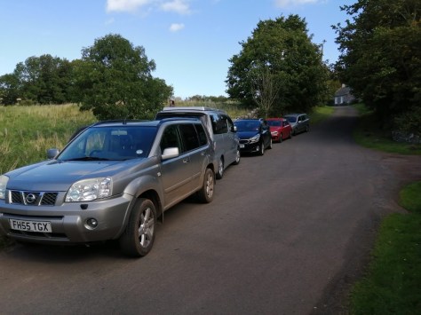
Back at the hole in the wall, instead of talking this like just shown, carry on until you reach a road, & turn right. This soon brings you to a small car parking area & the entrance to Hailes ‘fortalice’ Castle, which is well worth a look. I mean, its definitely the coolest ruin in East Lothian, one of the Seven Warsteeds that has seen its fair share of action over the histories.
Built in the 13th century, for two hundred years it was in the hands of the Hepburns, the last of whom – James, 4th Earl of Bothwell, was the principal instigator of the plot which murdered Darnley, second husband of Mary Queen of Scots. The Queen did sleep here during her lifetime. Another Hepburn of note was Sir Patrick of Hailes, who rescued the banner of Douglas from the hands of the English at Otterburn.


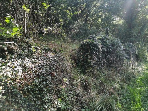
Leaving the castle, to continue along the Gododdin Trail return to the car-parking spot & cross the narrow road to the opening of a rough path-track going up the way. Keeping the garden wall of Hailes Cottage to the right, this is a handsome & wild section, with trees growing like banyans out of an old dry stone wall. It kinda reminded me of the abandoned imperial buildings on the Andaman Islands I had explored in my adventurous youth.


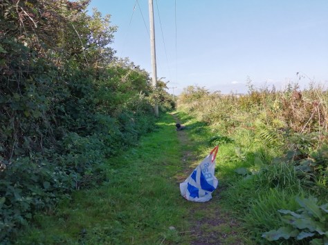
The path follows a gurgling silver burn on our right, which Daisy & our guest dog for the walk availed of its crystal advantages. You then come to a section of bramble-hedg’d fields where the public path takes some grand right-angled turns among resplendent views, especially of Traprain Law which starts to peep over the horizon to the south.


Personally I believe there is one grand turn too many – one section of the final square is far shorter & makes the much efficent walk than the circuitous ‘hike-for-ages-then-hack-your-way-through-a-rarely-used-overgrown-track-then-turn-back-along-the-road-to-the-point-where-you-would-have-appeared-ages-ago-if-you-had-simply-just-walked-up-the-side-of-the-field.’


Whether taking the ideal route or assaulting the long-winded one, you eventually arrive at a wall entrance to the Traprain universe. I’ve covered walking the summit & chatting about the famous Hacksilber hoard back in January, with that particular route tackling the slopes from more or less the point the Gododdin Trail arrives in the locality. The Gododdin Trail, however, will not be climbing Traprain – I don’t want to wear people out to much, there’s quite a few miles to do. Instead, follow loose paths through a boulevard of botany – Foxglove, Primrose, Brittle Bladder Fern, Peppered Rock Tripe, Tormentil & Ladies Bedstraw – beyond the cool ruined cottage & round the foot of the Law, passing other earlier W.E.L avatars on the trail of the Loth Stone only a pebble’s throw away.


In recent weeks I’ve been researching the Gododdin & have come up with some interesting stuff. For a start, it seems that the Gododdin might have been Picts. The giant silver chain found at Traprain, dated to the 5th-6th century, such as those used to mark Pictish kingship, adds solid support to such a notion. There also are some references in the old histories which, when placed side by side, indicate as much. The Pictish King List tells us, for example, that the Picts ‘came from the land of Thracia; that is, they are the children of Gleoin, son of Ercol. Agathirsi was their name. Six brothers of them came at first, viz, Solen, Ulfa, Nechtan, Drostan, Aengus, Leithenn.’ This places a section of initial Pictfall in Lothian, with Hektor Boece in his ‘History & Chronickles of Scotland’ stating ‘thee seeis betwix Cathnes and Orknay war namit Pentland Firth ; and all the landis, quhilkis ar now callit Louthiane, war callit than Pentland.’ Through the Old Scots we can learn that the Lothian Pentland Hills & the Pentland Firth are named after the Picts, or Pehts.


William Camden provides more information about a Pictish Lothian, recording that at, ‘the time of Reuther King of Scots,’ a battle was fought in which the death of a certain, ‘Gethus King of the Picts… constrain’d the Picts (who perceived themselves unable to resist) to fly, some by land and others by sea, to Orkney, where they abode for a time, and made Gothus, brother of the foresaid Gethus, their King. And after a few years, having left some of their number to people and plant the Countrey, they return’d to Louthian; and having expelled the Britons, settled themselves again in their ancient possessions.’ Here we see that the two main bases of the earliest Picts were the Orkneys & the Lothians, the latter name linking to Leithenn, one of the six Pictish brothers who first came to settle in Britain. We also have a Gothus, after whom the Gododdin may have been named, & his arrival in the Lothians roundabout the year zero totally fits with the archeological record of Traprain being refortified in the first century AD. What is also fascinating is that in the History of the Kings of Britain by Geoffrey of Monmouth, King Loth himself was recognised as a king of both Lothian & the Orkneys. Food for thought indeed!

We also have the presence of Cunedda in the Pictish King List, where he appears as Canutulachama. His successor in the King List, Wradech, reflects the name of one of Cunedda’a sons, named in the Brythonic traditions as Ceretic. Canutulachama is dated to the mid-fourth century, which fits perfectly into a passage from m Nennius (9th century) , which has Cunedda leaving Lothian for Wales
Maelgwyn, the great king, was reigning among the Britons in the region of Gwynedd, for his ancestor, Cunedag, with his sons, whose number was eight, had come previously from the northern part, that is from the region which is called Manaw Gododdin, one hundred and forty-six years before Maelgwn reigned. And with great slaughter they drove out from those regions the Scotti who never returned again to inhabit them.
Recent, widely-trumpted DNA analysis has shown that 0.8% of all Welshmen have close links with the Pictish marker of the Maeatae, which is cool support, but that’s enough of that for now, I think I’ll have to write a book to support the trail – maybe do a cool app for phones & stuff. First things first, I have to traverse the entireity of it, taking photos & everyfink!


Another bit of research I’ve done is on the origins of the fabulous treasure hoard found at Traprain, a portion of which is currently on display in the John Gray Center, Haddington. Its basically a case of joing the dots & seeing what you see, but the coincidences are quite canny. We begin with the poet Claudian who describes in a couple of texts the Roman General Stilicho putting an end to an assault of Britannia.
The Saxon conquered, the Ocean calmed, the Pict broken, and Britain secure. In Eutropium… When I too was about to succumb to the attack of neighbouring peoples – for the Scots had raised all Ireland against me, and the sea foamed under hostile oars – you, Stilicho, fortified me. This was to such effect that I no longer fear the weapons of the Scots, nor tremble at the Pict, nor along my shore do I look for the approaching Saxon on each uncertain wind. On the Consulship of Stilicho

These events happened in 398, the same period as when the last coins in the Traprain Law could be dated. To my mind, the Traprain treasure helped buy off the Picts, for a highly similar hoard dated to the same period was found at Coleraine. This would of course be to appease ‘the Scots had raised all Ireland.’ Strictly numismatically speaking, the Coleraine hoard’s latest coin is Constantius III (407-411), but its still the end of Roman rule in Britain time & the Scots were attacking Britain after Stilicho’s intervention – & the coins might simply have been added to the bribe hoard later.
As for the Saxon invaders, we get to them via certain elite status silver fittings, whose rare double-triangle containing a flower motif was found at Coleraine & also at Ejsbol in Denmark. ‘The round strap-end from {the Traprain hoard},’ writes Sonja Marzinzik, ‘is one of the few chip-carved silver belt fittings & is related to the Esjbol strap-end.’ That the weapons of about 60 warriors were discovered in the Esjbol bog suggests they could have belonged to the Saxon warriors who no longer harrassed the British shores. There’s more to my studies, but the coincidences can’t really be ignored.

Back on the Trail itself, the path we were following at the foot of the craggy slopes of Traprain turns west in the direction of a large & wobbly stepping-stile into a field, which had been thoroughly harvested on our arrival. It tosses one onto a crude path, which in the cornucopia of summer leads you through elbow-brushing crops to another quiet slice of country tarmac & a small yet practical place to park the car. Once here turn left for a couple of hundred metres or so.


As we pass’d Traprain on our left, I couldn’t help but feel what an intelligent piece of stone she is. You can really feel her personality. Then, as soon as we reach’d the trees that line the road on the left, turning right brought us to a fine farm-road leading down into the valley of the Luggate Burn & back up again. This is where the Trail continues.


The view of tree-topped Lawhead Hill here is splendid, with the escarpment-topping obeliskean Balfour Monument piercing the sky to its right like Cleopatra’s needle. It was erected to the memory of (1820-56), the father of both British Prime Minister Arthur Balfour (1848 – 1930) who we’ll be looking at more in the next post.


You now come to the wide & spacious fields of Cockielaw farm, with a lovely solitude descending as a psalm for the soul. Again we had to follow wide-sweeping right angular tracks which eventually reached another road, which one should turn right along. After a wee while you come to a fork, the left turn of which is pointed out by a shiny new sign saying PAPPLE 1/2 A MILE… which is where we shall be heading in the next post.


To contribute petrol & petfood
Please make a donation
***
