


So begins the penultimate leg of the Gododdin Heritage Trail. My original plan was to have it done by Christmas, & focus on walks around other parts of the county for 2020. Of course the festive season got in the way of all that, but we’ll be finished soon enough so all good!

For a new decade I shall be introducing a new feature – a paypal button. I mean, I do all this for free, but a bit of petrol money will never go amiss, & Daisy always needs feeding. The first fifty pounds, by the way, will go towards upgrading the site & getting rid of all those alien adverts!


We were last in Gifford, enjoying the succor & scenery. At this point the Trail follows the course of the Haddington road for about a third of a mile. It is possible to traverse some of this section via the field to the right, however, if the traffic does your head in.

At the foot of the slope one comes to a wee parking area on the left & a gate. Passing through the latter, one arrives at one of the best kept paths in the county. With a fence on one side & a riverlet on the other its also great for de-wandering dogs, I take some of my feistier Fetch East Lothian clients there.


What follows is a lovely mile or so of meandering by illustriously crystal waterflow & under ruggedly gushing woods. After a bit you’ll come to a gate in a tall deer fence. This should be taken. It is also possible to follow the path to the left, which trundles on delightfully all the way to the village of Bolton. At one point you can even turn back on yourself & head towards this point, forming the aforetitled Colstound Loop. At the end of this post I’ll show you just how that one goes.


Back to the main trail, one now begins a mild ascent through some extremely pretty woodland, especially in winter when one can gaze effortlessly through the branches at the rivervale below.


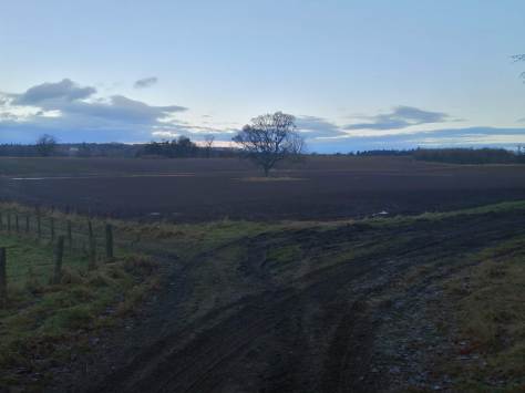
At the top of the rise you’ll reach another gate & then enter a huge section of field. Following the path, you pass a house on the left & come to a farm track. At this point the footpath heads straight ahead, indeed to follow the Colstoun Loop you will keep going. However, for the concerns of the Heritage Trail we shall here be turning right & heading along the farm track.


About 200 meters up the way the track forks, where we’ll be going left, skirting the field with a large gamebird pen area on our right. The track then turns right, then right again at the end of which there is a house on the left just before a T-Junction. Turn left here.


The next section heads north towards Haddington, a lovely & serene stroll through the Colstoun Estate. My searching for Gododdin has led me to make a match between the name Colstoun & that of Golstan. In the Gododdin poem we read (my translation);
It was his heart’s first custom to defend,
Gododdin versus very best of foes,
In battle’s van avenging vehemence,
It was his body’s custom, lion-swift,
To run on predatory shifting hordes,
Custom it was for Golstan’s sov’reign son
To listen to his father’s worldly words,
Custom was kept when Mynyydawg him held
To ruin regal shield & redden lance
Before the lord of Eidyn, Urfai, sworn.
Elsewhere in the Dark Age genealogies we see an Uffa, son of Guillam Guercha; with the Guil- element connecting to the Gol- of Golstan and Uffa connecting to Urfai. The Guercha element then leads us to a 6th century northern warrior known as Gwrgi, who appears with his brother in several sources.
Gwrgi & Peredur are the sons of Eliffer of the Great Retinue son of Arthwys son of Mar son of Keneu son of Coel
Descent of the Men of the North573: The battle of Arfderydd between the sons of Eliffer and Gwenddolau son of Ceidio; in which battle Gwenddolau fell; Merlin went mad.
Annales Cambraie580: Gwrgi and Peredur – sons of Elifert – died
Annales Cambraie

Here we see plenty of genuine historically attested Arthurian references;- Arthur himself appears as Arthwys, Peredur is Pheredur, the legendary found of the grail, while Merlin is, well, Merlin.
Near Bolton is the site of a Gododdin hillfort, which I am suggesting was once the main estate of Golstan/Gwrgi. You can”t really see it anymore, but I’ve found this wonderful website that shows you all the hillforts in Britain. Here’s East Lothian.

Summary: Cropmarks have revealed the site of a complex fort occupying the summit of the low hill above Bolton. The most coherent element of the defences is a belt of three roughly concentric ditches swinging round the NE, SE and SW flanks. On the NW, however, no fewer than five lines are visible on the aerial photographs, and of these only the outermost can be correlated to the rest of the circuit with complete confidence, pierced by entrances on the NNE and SW respectively. In contrast, the innermost on the NW, clearly intersects the belt of defences on the NNE, re-emerging between the inner and middle ditches on this side, as does the second line, though this latter may also correlate to the innermost round the rest of the circuit. Evidently the confused appearance of the cropmarks is the result of the eccentric superimposition of two separate enclosures, both of roughly the same size, the one oval on plan within the two narrow ditches or possibly massive palisade trenches visible on the NW and an entrance on the SW, and the other sub-oval, measuring 90m from NE to SW by 80m transversely (0.56ha) within the three ditches visible elsewhere. None of these ditches is particularly broad, typically measuring no more than 2m in breadth, but the belt they form is between 22m and 26m deep, expanding to 30m at the entrance on the NNE. And while the outermost appears the broadest, in places up to 4m in breadth, the ragged outline of its W terminal at the N entrance suggests it is a composite mark hiding several recut lines; likewise at the SW entrance, where a spur of the ditch on the NW side of the gap doglegs sharply outwards to create an overlap with the opposite ditch terminal, this spur ditch is no more than 2m in breadth. Undoubtedly, however, the defences are more complex than this simple resolution of the sequence into two separate perimeters, and there are traces of other linear features, some of them possibly palisade trenches, but also including two segments of a broad ragged mark between the second and fourth lines on the NW. No clear features are visible within the interior, but one macula on the S probably marks the stance of a timber round-house.
HER: East Lothian Council MEL1125

Back on the trail, we were winding here, winding there, & eventually coming to a junction of sorts. Instead of heading to the main house, drive forward along the field edge. At the start of the next field, head right along the line of the fence, then bend to one’s left. Another couple of hundred metres or so & one reaches a long straight stretch of tarmac. Its also a great place to park the car if you wanted to try the Colstoun Loop. This is where we’ll rest our walk, with only Lennoxlove seperating us from closing the circle…


THE LOOP


To contribute petrol & petfood
Please make a donation
***

We did some of this today, it was absolutely gorgeous! Hadn’t expected it to be so forest-y, just lovely. Thanks!
LikeLike